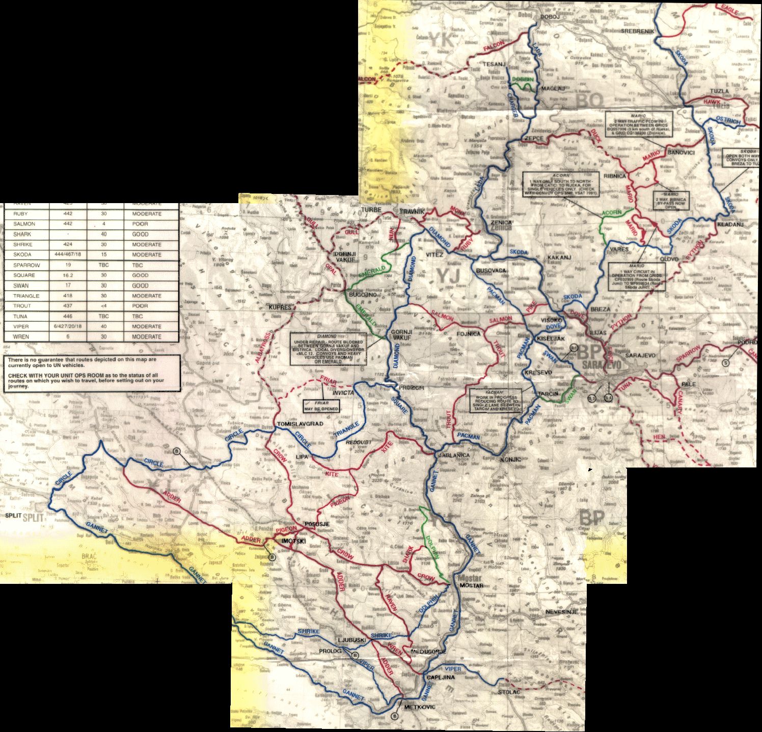
Mosaic image of the 3 separate scans
With Erdas Imagine 9.1 we (Henk and I) corrected the files and mosaic-ed them together. Finally ! all the maps together in 1 file.
The Mr. Sid encoded img file is attached below. Irfanview (free image viewer) can display Mr. Sid encoded files.
The yellow bands in the raster file are scanner artefacts. We tried to keep them out of the composed image but on the edges that wasn't possible.
Some more background info:
This was the map we had in our ambulance. It was a laminated UN route map for Bosnia. The routes had code names like: 'Diamond', 'Triangle', 'Kite' etc. Some info on the accessibility of the routes is included too. This particular map was just for our own reference, we didn't have to find our way with it. But, the convoy commanders didn't have much better maps.
Srebrenica and Potocari are not on this scan. I didn't make a full scan of the map unfortunately. These two cities are roughly to the east of Tuzla. So if anyone has a full map, or scans of maps please let me know !
Note: the raster image is not ortho-rectified yet.
Image Taxonomy:
| Attachment | Size |
|---|---|
| 2.73 MB |
- Log in to post comments
- 15893 reads